Maps of the entire site area…
For documentation and orientation purposes, this section was provided to show the entire site area and subject area of focus which is Middle Taylor Township, Cambria County (Johnstown), Pennsylvania. Maps were obtained from the USGS National Map site at the website link provided at the very bottom of this page and from Google Earth Pro.
The first map is an overall view of the site area of focus at a larger scale (Map 1 of 26). Subsequent maps are aerial and topographic maps at smaller scale and which begin at the south end of the site area of focus (at Minersville in the Cambria City section of the City of Johnstown) and then continue north to through the township to end of the site area of focus (at the back end of the Hinckston Run dam-reservoir).
In general, on all the exhibit maps, the entire Hinckston Run stream valley is shown between the confluence with the Conemaugh River in Minersville and north to the Hinckston Run dam-reservoir. The former/current Riders Dump (Rosedale) Disposal Area would be situated to the right (east) of the Hinckston Run stream at about the mid-point between Minersville and the Hinckston Run dam-reservoir.
The last series of maps are mining maps obtained from the Pennsylvania Mine Map Atlas.
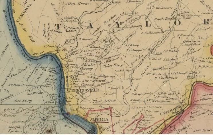
MAP 1 of 26: This is a historic 1867 Map of Cambria County. At the bottom middle of the map where it says “Cambria” is where Hinckston Run converges with the Conemaugh River at Minersville in the Cambria City section of the City of Johnstown. The Hinckston Run dam-reservoir can be seen in the upper right-hand part of the map where the “O” is in the word “Taylor”. (Source: Library of Congress - from the Cambria County Recorder of Deeds Office website)
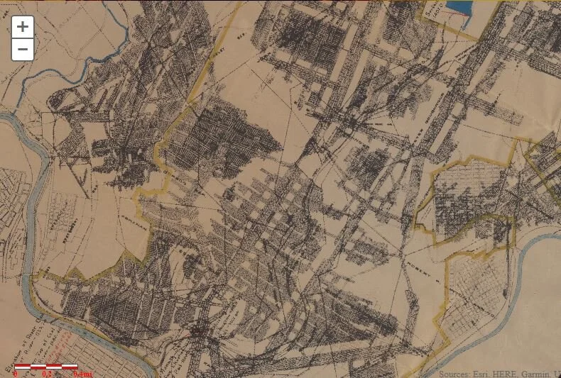
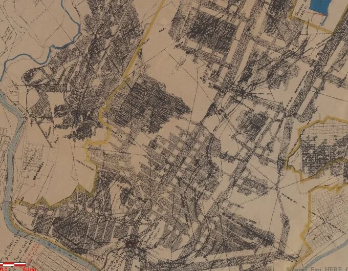
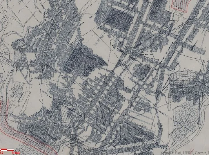
MAP 2 OF 26: Overall map of the entire subject area of focus. Hinckston Run converges with the Conemaugh River at Minersville in the Cambria City section of the City of Johnstown. The Hinckston Run dam-reservoir can be seen in the upper right-hand part of the map. (Source: USGS National Map)
Aerial Maps
Aerial Maps

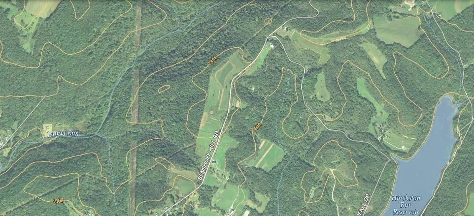
MAP 3 of 26: Aerial map showing Minersville, Iron Street, Honan Avenue, Prosser Hollow, Benshoff Hill Road, Valley View, and Benshoff Hill (southern Middle Taylor Township).
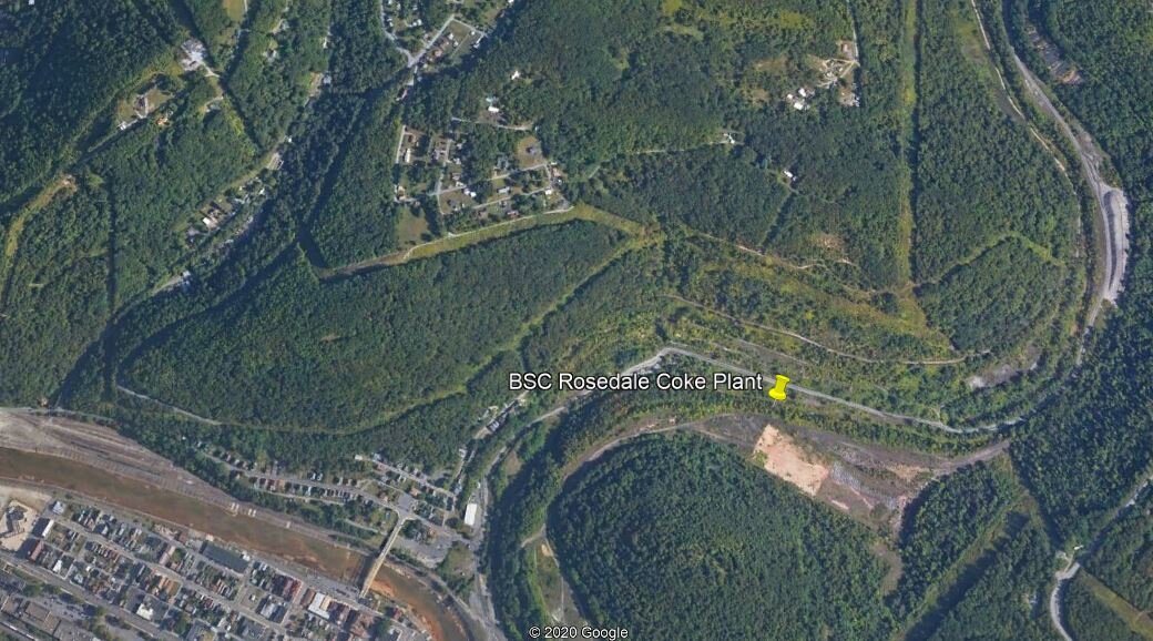
MAP 4 of 26: Another aerial map perspective of the same area as above (southern Middle Taylor Township). The location of the former Bethlehem Steel Rosedale coking plant is shown with the yellow pin.

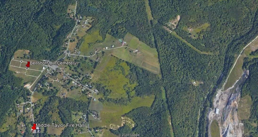
MAP 5 of 26: Aerial map showing Benshoff Hill Road and Linkville Road (south-central Middle Taylor Township).
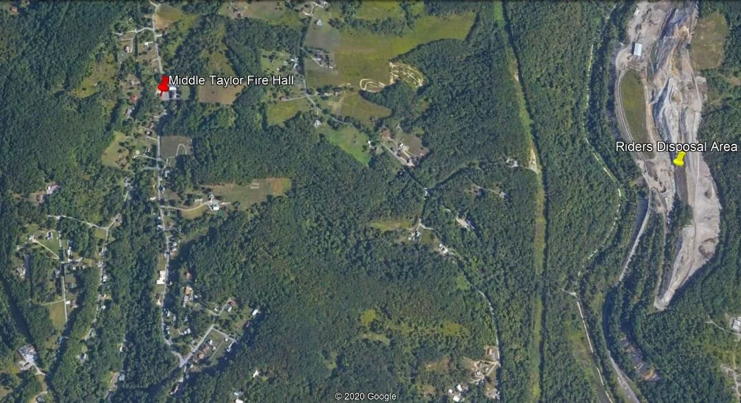
MAP 6 of 26: Another aerial map showing the same general area as above (south-central Middle Taylor Township). The fire hall is shown with the red pin.
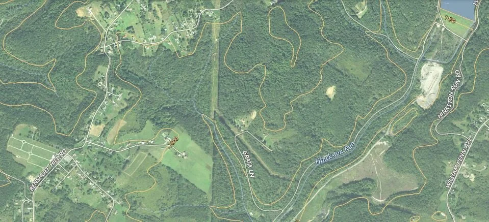
MAP 7 of 26: Aerial map showing Benshoff Hill Road, Linkville Road and Hinckston Run Road - Waterfall Drive (central Middle Taylor Township).
MAP 8 of 26: Another aerial map showing the same general area as above (south-central and central Middle Taylor Township). This map shows Benshoff Hill cemetery in the middle-left (west).
MAP 9 of 26: Another aerial map showing the same general area as above and two above (central Middle Taylor Township).

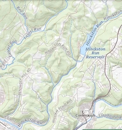
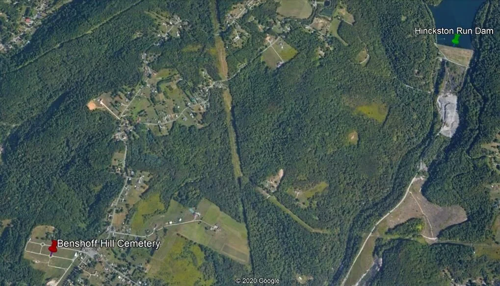
MAP 10 of 26: Aerial map showing Benshoff Hill Road, Hinckston Run Road - Waterfall Drive and the front end of Hinckston Run Reservoir at the dam (north-central Middle Taylor Township).
MAP 11 of 26: Another aerial map showing the same general area as above (north-central Middle Taylor Township). The Hinckston Run Reservoir (dam) is on the right side of the map at the location of the green pin.
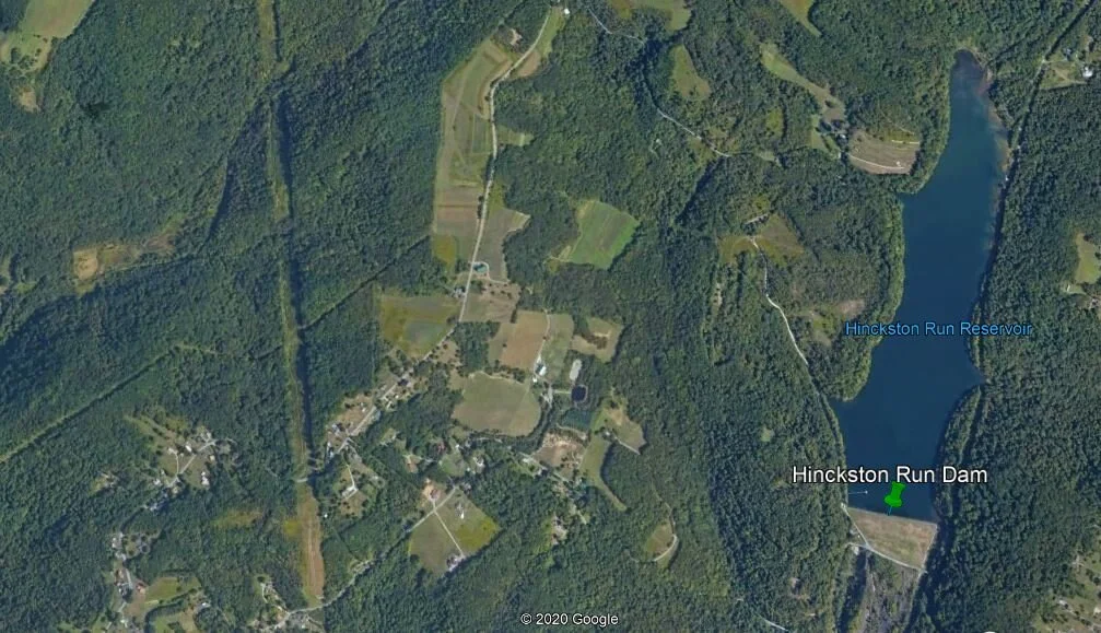
MAP 12 of 26: Aerial map showing Benshoff Hill Road and the back end of Hinckston Run Reservoir (northern Middle Taylor Township).

MAP 13 of 26: Aerial map showing another perspective of the same general area as above (northern Middle Taylor Township).
Topographic Maps
Topographic Maps

MAP 14 of 26: Typical cross-section through the area showing elevation differences between the stream through Prosser Hollow (west) through the hill east to Hinckston Run at the Riders Dump (Rosedale) Disposal Area. Some of the features we have talked about through the website are listed.
MAP 15 of 26: Topographic map of the site area south starting at the Minersville section of Cambria City in Johnstown then working north. Some of the features we have talked about through the website are listed.

MAP 16 of 26: Same topographic map as above but with heavier contour lines and elevations labeled.

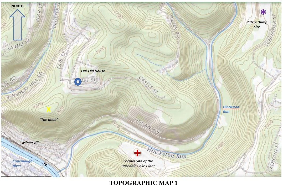
MAP 17 of 26: This is the next topographic map of the site area just north of Topographic Map 1 and IA and continuing to work north. Again, some of the features we have talked about through the website are listed.

MAP 18 of 26: Same topographic map as above but with heavier contour lines and elevations labeled.

MAP 19 of 26: This is the next topographic map of the site area just north of Topographic Map 2 and 2A and continuing to work north. Again, some of the features we have talked about through the website are listed and you can now see the Hinckston Run dam and reservoir in the upper-right (northeast) corner.
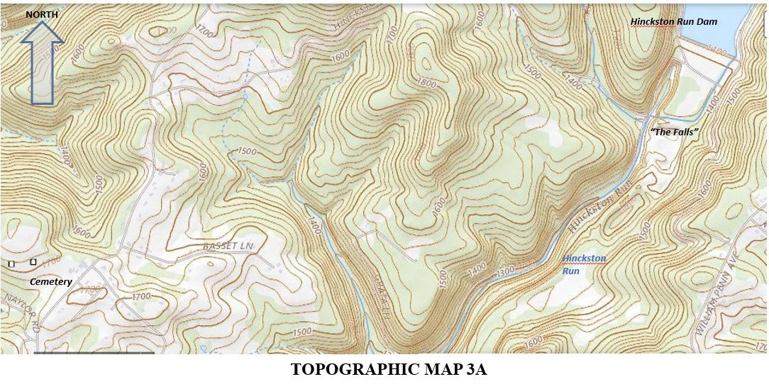
MAP 20 of 26: Same topographic map as above but with heavier contour lines and elevations labeled.
Mining Maps
Mining Maps
MAP 21 of 26: Mining Map 1 - This is a general index map for all of the mining maps shown below. The maps show the amazingly extensive network of deep mines below the entire area of focus. Similar to other maps provided in the website, the spot where the Hinckston Run stream converges with the Conemaugh River in the Minersville section of Cambria City is at the bottom left of the map and the Hinckston Run dam-reservoir is at the top in the middle of the map. (Source: Pennsylvania Mine Map Atlas, 2014 Penn State University minemaps.psu.edu)
MAP 22 of 26: Mining Map 2 - Again the spot where Hinckston Run converges with the Conemaugh River in the Minersville section of Cambria City is at the bottom left of the map and the Hinckston Run dam-reservoir at the upper right-hand corner of the map and is a blue color. (Source: Pennsylvania Mine Map Atlas, 2014 Penn State University minemaps.psu.edu)
MAP 23 of 26: Mining Map 3 - Again the spot where Hinckston Run converges with the Conemaugh River in the Minersville section of Cambria City is at the bottom left of the map and the Hinckston Run dam-reservoir at the center top right of the map. (Source: Pennsylvania Mine Map Atlas, 2014 Penn State University minemaps.psu.edu)
MAP 24 of 26: Mining Map 4 - Again the spot where Hinckston Run converges with the Conemaugh River in the Minersville section of Cambria City is at the bottom left-hand corner of the map and the Hinckston Run dam-reservoir is at the upper right-hand corner of the map and is a blue color. (Source: Pennsylvania Mine Map Atlas, 2014 Penn State University minemaps.psu.edu)
MAP 25 of 26: Mining Map 5 - Again the spot where Hinckston Run converges with the Conemaugh River in the Minersville section of Cambria City is at the bottom left-hand corner of the map and the Hinckston Run dam-reservoir is at the upper right-hand corner of the map and is a light blue color with red hatching. (Source: Pennsylvania Mine Map Atlas, 2014 Penn State University minemaps.psu.edu)
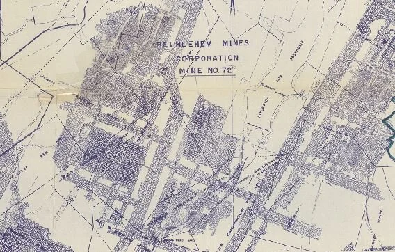
MAP 26 of 26: Mining Map 6 - The Hinckston Run dam-reservoir is near the center-right of the map and is labeled. You can also see the label for Bethlehem Mines Corp. Mine No. 72. (Source: Pennsylvania Mine Map Atlas, 2014 Penn State University minemaps.psu.edu)