
MAP 18 - Water tank at high point Elevation 1735, ie. the “Tanks” from the old “rogue” drinking water system in the Benshoff Hill/Valley View section of south Middle Taylor Township. Benshoff Hill Road is to the left (west).

MAP 19 - Map of the location of the Pumphouse SIte/Lot just southwest of the intersection of now Earl Street and Blackberry Street at County Parcel No. 40-006.-220.000 at Elevation 1558 (USGS National Map). This pumphouse site/lot was part of the “roque” drinking water system that served the Benshoff Hill/Valley View and Linkville Road sections of central and southern Middle Taylor Township until the municipal public drinking water system was extended up out of the City of Johnstown.

PHOTO 9 - Recent photograph of the Pumphouse Site/Lot just southwest of the intersection of now Earl Street and Blackberry Street at County Parcel No. 40-006.-220.000 at surface Elev. 1558 (USGS National Map).
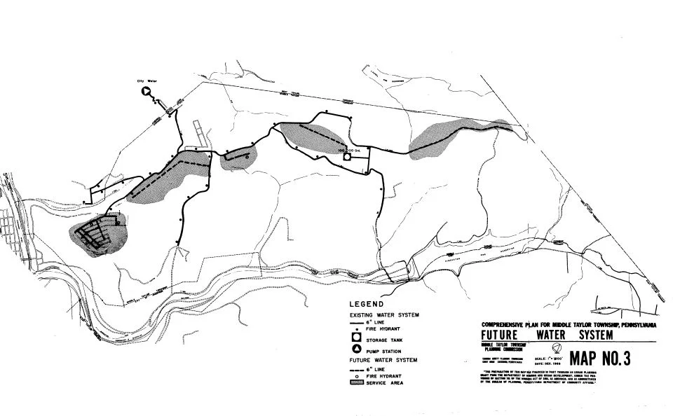
MAP 20 - Future water system map from the 1969 Long Range Plan report for Middle Taylor Township (Cambria County Planning Commission). Minersville and the Cambria City section of the City of Johnstown is on the left side of the map.

MAP 21 - Aerial imagery showing the existing location of the above ground water storage tank which was part of the new water system extension to the Benshoff Hill/Valley View section and most of Middle Taylor Township in the late 1970’s. This tank is in the central part of Middle Taylor Township and feeds the water system which is in the Township.

MAP 22 - Platted and unimproved roadway known as “The Alley” in the Benshoff Hill/Valley View section of southern Middle Taylor Township. This linear corridor is the smaller width strip situated to the right (east) of now 196, 208 and 223 Castle Street (source Cambria County FEMA Flood Hazard Mapping).